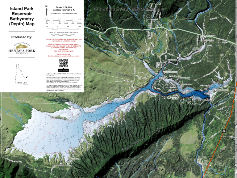
Free Island Park Reservoir Map
Background This blog is a how-to for use of a new free bathymetric (depth) and recreation map of Island Park Reservoir. The map is intended to potentially help anglers locate fish and facilitate responsible recreation. We hope this map will increase appreciation of Island Park Reservoir and create awareness of the value of work to fix water quality issues that affect the reservoir, the Henry’s Fork, and the fish and hatches within. Currently, the map is digital-only, but a hard-copy map is in the works! This free map is made possible by Federal and State grants as well as private donations that fund the HFF’s non-profit science and technology program. If you want to support our efforts to provide tools that assist with your fishing day or our programs that address threats to fish and fishing, please consider donating to the Henry’s Fork Foundation here: https://henrysfork.org/donate Directions for use: Dynamic GPS use with Avenza Maps (Apple iPhone and Android) Avenza Maps is a free app that allows users to view maps offline on their smart mobile devices and locate their position using GPS. Users can download maps for use offline, see their location on the map in real time, mark