Background
This blog is a how-to for use of a new free bathymetric (depth) and recreation map of Island Park Reservoir. The map is intended to potentially help anglers locate fish and facilitate responsible recreation. We hope this map will increase appreciation of Island Park Reservoir and create awareness of the value of work to fix water quality issues that affect the reservoir, the Henry’s Fork, and the fish and hatches within.
Currently, the map is digital-only, but a hard-copy map is in the works!
This free map is made possible by Federal and State grants as well as private donations that fund the HFF’s non-profit science and technology program. If you want to support our efforts to provide tools that assist with your fishing day or our programs that address threats to fish and fishing, please consider donating to the Henry’s Fork Foundation here: https://henrysfork.org/donate
Directions for use:
Dynamic GPS use with Avenza Maps (Apple iPhone and Android)
Avenza Maps is a free app that allows users to view maps offline on their smart mobile devices and locate their position using GPS. Users can download maps for use offline, see their location on the map in real time, mark waypoints, create tracks, and measure distances. Avenza is different from other mapping apps (such as On-X, Gaia GPS, GoHunt, Navionics, etc.) because it allows the user to download and use custom maps that otherwise aren’t available.
How to download, import, and use the new Island Park Reservoir digital map:
1) Install the free Avenza app on a smart mobile device using the Apple App Store or Google Play Store.
2) Open Avenza Maps on the mobile device. As with any other GPS-enabled app (like Google Maps or On-X), the user will need to agree to allow the app to access your location.
3) To download the map, there are three options:
- Click or tap on this link: Island Park Reservoir Bathymetry (Depth) Map
- In the Avenza app interface, go to “Store”. Use the search bar (try “Island Park Reservoir Bathymetry”)
- Also in the Avenza Store, users can use the “Explore on a map” function
4) Once users have found the correct map, click or tap on the green “Free” button to download the map. Once downloaded, the map will be available on the “My Maps” tab in Avenza. Once the user navigates to “My Maps”, the user can tap on the map thumbnail to open the map.
5) Once the map is open, the user can use their mobile device just like any other GPS. The user can view their real-time position on the map, which is shown as a blue dot. If moving, the user’s direction of travel is marked with a blue arrow. Map navigation is intuitive, the user can use their fingers to zoom and rotate. There are buttons to mark waypoints, snap to current location, measure distances, etc.
Troubleshooting:
If the above are not working, users can click on the button below to download the map .pdf file to your mobile device.
Once downloaded, use the following steps to import the map to Avenza:
1) Open Avenza
2) Go to “My Maps”
3) In the upper right hand corner, tap the “+” sign to add a map.
4) Select “Import maps”
5) Select “From storage locations”. From here, you’ll have to search through your device’s files to find the downloaded .pdf file.
If Avenza isn’t working or you don’t have access to a smart mobile device, no problem. Users can download the .pdf file here on your mobile device or home computer. Once downloaded, users can view the map with any mobile app or computer program capable of viewing .pdf files. With this method, users will be able to see the map just fine but won’t be able to use GPS functionality like viewing the user’s real-time position on the map or marking and saving waypoints.
Why are we making this map available?
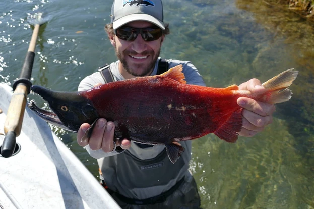
Island Park Reservoir is worth protecting but it has its challenges. It has incredible potential to produce amazing dry-fly fishing for wild and native fish, including rainbow trout, kokanee salmon, and the beautiful Yellowstone Cutthroat trout, but it’s coming up short because of water quality problems. Plus, these problems in Island Park Reservoir affect water quality and fisheries downstream. We know what the problems are, and we want to implement solutions that would ignite the fishery’s potential and unleash the economically and ecologically valuable fish and wildlife resources the Henry’s Fork Watershed is famous for.
The Henry’s Fork Foundation has launched the “Developing Infrastructure to Reduce Temperature and Turbidity” (DIRTT) project to leverage Federal grants and work collaboratively with the local community and management partners to fix key water quality issues that harm the ecology and recreational economy of the Henry’s Fork River. The HFF has launched the DIRTT project to improve water quality and fisheries in the Henry’s Fork watershed, especially in Island Park Reservoir and its outflows into Box Canyon and Harriman State Park. The DIRTT project is a big new initiative. We hope this map will increase awareness of the reservoir’s potential and get the word out about DIRTT as we work together to care for our common home.
Becoming a member of the Henry’s Fork Foundation is a great way to support our work. Your support makes initiatives such as this map—and the larger DIRTT project—possible. Thank you! https://henrysfork.org/donate

Important Disclaimers
ATTENTION: EXERCISE CAUTION
Island Park Reservoir contains unmarked hazards. These hazards, along with depth readings and shoreline locations, change as water levels fluctuate. Watercraft operators should NOT rely exclusively on this map for navigation purposes.
Annual water level fluctuations often exceed 15 feet. Visit www.usbr.gov/pn/hydromet/ramps/island/island.html to see current water levels.
This map depicts water depths when the reservoir is full and water surface elevation is 6,303 feet above sea level. Users can subtract the current surface water elevation from the full-pool elevation of 6,303 to develop an offset to the depths on this map.
Island Park Reservoir, ID, Bathymetry (Depth) and Recreation Map © 2024 by Henry’s Fork Foundation is licensed under CC BY-NC-SA 4.0
This map is distributed in the hope that it will be useful, but WITHOUT ANY WARRANTY; without even the implied warranty of MERCHANTABILITY or FITNESS FOR A PARTICULAR PURPOSE. This map is not a legal document. Boundaries, labels, and depth may be generalized for this map scale. Land ownership is not shown, obtain permission before entering private lands. Changes may have occurred since these data were collected and some data may not longer represent actual surface conditions.
Datum: North American Datum of 1983 (NAD83)
Projection: Universal Transverse Mercator, Zone 12.
Basemap: US Geologic Service 10m Digital Elevation Model with hillshade, 2011 US Department of Agriculture National Agricultural Imagery Program, and Open Street Map roads.