Eastern Idaho just had its warmest winter on record—and a changing climate may mean more warm winters to come. Warm winters have big implications for our snowpack, and consequently, the water that supports our fisheries. How? Snowstorms build mountain snowpacks. When a snowpack melts, some of the water is absorbed by soil, recharging groundwater and giving thirsty plants a drink. The rest of the water runs into rivers and reservoirs. In the winter, our mountain snowpack is our cool, clear river and reservoir water.
When the snowpack shrinks, the fishery suffers. A smaller snowpack means a smaller water supply, and more reliance on water stored in reservoirs to meet summertime irrigation demand for agriculture. In years with a small snowpack and low water supply on the Henry’s Fork, Island Park Reservoir is often drawn down to low levels, and fast. The relationship between water supply and reservoir operations has implications for summertime water quality and wintertime fish habitat. Thus, the entirety of the Henry’s Fork, and the fish in it, depend on snowpack for stability.
How do we prepare for warmer winters, and their impact on the fishing season? As we experience record-breaking conditions, understanding the future of snow is crucial to conserving the future of the Henry’s Fork fishery.
How Does Snow Impact Our Fisheries?
Snow affects our fisheries in a lot of ways—all of them very important to a good fishing experience. The cool, clear water of Big Springs that creates the Henry’s Fork comes from groundwater. This groundwater is recharged every season by snowmelt. In fact, the amount of water flowing out of Big Springs is the direct result of how much snow fell on the Yellowstone Plateau three years ago. But the connection between snow and the Henry’s Fork fishery gets even more direct: winter habitat for juvenile trout is the only limiting factor for rainbow trout populations from Island Park to Riverside. Winter trout habitat in this reach is almost entirely dependent on outflow from Island Park Reservoir, which is dependent on reservoir levels. And what’s a huge factor in reservoir levels? You guessed it: the previous winter’s snowpack and subsequent snowmelt.
Current Infrastructure and Challenges.
2026 was our warmest winter to date. Our watershed is facing never-before-seen-conditions, so water managers need innovative solutions to make the smartest possible decisions. Springtime streamflow predictions are a critical part of making sure our water supply lasts through the irrigation season. Currently, Idaho’s snow monitoring sites (called SNOTEL sites) help predict springtime streamflow based on the historical record, and are often very accurate. Each April, water managers make runoff predictions by matching current conditions to a similar year in the historical record. These predictions are valuable, but they become less accurate when there’s no example of similar conditions in the historical record—exactly like the winter we just had.
Idaho’s SNOTEL system has 21 stations in the Henry’s Fork watershed and Snake River headwaters. But these existing stations all operate in locations with similar terrain, across a relatively narrow elevation band. This lack of variety, combined with their reliance on the historical record to make highly accurate predictions, creates gaps in our summertime preparedness—gaps that HFF’s new stations aim to address.
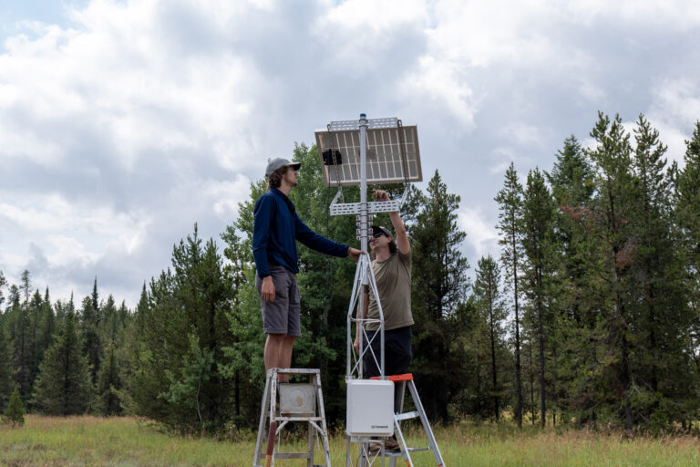
Sam Pruitt and Dr. Otto Lang installing a snow study station near Island Park Dam
HFF’s Snow Study Stations.
In response to warmer winters, HFF is also turning up the heat with new partnerships. As part of a $400K federal WaterSMART grant, Boise State snow scientist Dr. Otto Lang, assisted by Baucus Climate Scholar Sam Pruitt, will build and install six new snow study stations across the Upper Snake River Basin. Our stations will be designed to collect data primarily from the atmosphere, which lets us measure the conditions that lead to snowmelt. Snow melts in large part because it absorbs solar and thermal radiation, and by measuring these variables, we gain a deeper understanding about how snow accumulates and melts. This understanding is a critical need to more accurately predict springtime snowmelt and runoff into rivers and reservoirs. Data collected by these new stations will expand HFF’s real-time monitoring network from river bottoms to mountaintops. With more data from across the watershed, we will have a better understanding of current watershed conditions and improve our ability to help prepare water managers and the angling community accordingly.
So, where will these new stations be installed? Three HFF stations will be close to existing SNOTEL infrastructure—at Island Park, Salt River Summit, and Togwotee Pass. SNOTEL sites primarily measure snow water equivalent (SWE), which is how much water a snowpack will become when it melts. Our snowmelt stations will supplement SNOTEL data, which has been around for many decades, with new variables, including radiation, wind speed, and relative humidity, giving these locations a record of all meteorological variables that influence the snowpack. This allows for a process-based understanding of snow accumulation and melt, rather than simply knowing how much snow there is. Our stations will have a mutually beneficial relationship with existing SNOTEL sites, each providing the other with deeper insight.
The other three HFF stations will be installed at Teton Pass, the Big Hole Mountains, and on the Madison Plateau—underrepresented locations that are less typical for snow study, and higher elevation locations. Expanding station coverage means we can learn more about how snowpack functions in the entirety of the watershed. With more information about what’s making snow melt, and when melt will happen, it will be easier to make springtime streamflow predictions across the basin that don’t depend on comparison with a similar year in the historical record. But that’s only one piece of the puzzle.
Modeling Snowmelt.
Data from our snow study stations will be insightful on their own, but will also be extremely valuable for another application—snowmelt modeling. A useful way to understand how much snow is in your basin is to use a computer model that “builds up” and “melts out” the snowpack based on weather conditions. The model we use, iSnobal, predicts how snow is distributed spatially across a basin, and uses atmospheric conditions information to determine how much snow there is, where it is, and when it will melt. Why does this matter? The model provides detailed insight into snow conditions beyond the location of the snow study stations, expanding predictions of springtime snowmelt runoff across the entire basin.
Why is This So Important?
Snow monitoring is critical to the Henry’s Fork watershed. Winter habitat for juvenile trout in Box Canyon, as well as cool, clear water year-round, are dependent on mountain snowpack, making snow a critical factor in your fishing experience. But it doesn’t end there.
Much of the American West depends on mountain snowpack for its water supply, and in 2026 many places faced the same conditions we did—if not worse. For example: Utah, which gets 95% of its water from snow, had the lowest snowpack since 1930. Seventy-six percent of the state faced extreme drought (the second-highest level of drought) this summer. But the problem goes far beyond us and our neighbors. One-sixth of the world depends on snowmelt for water, which means higher accuracy in snowmelt predictions is in high demand. Locally, our reliance on snowmelt is even greater: in Idaho, and the rest of the American West on average, 75% of our water comes from mountain snowpack. Building knowledge about snowmelt doesn’t just brighten Idaho’s future, or that of the West, it brightens the world’s.
Better understanding our snowpacks isn’t just an option, it’s key to protecting water supply in a changing world. If you want to read more about how HFF will study snow to advance water supply predictions and arm the Henry’s Fork watershed against warming weather, read Dr. Otto Lang’s 2025 presentation to the Henry’s Fork Watershed Council here.
Project Partners
The “Snowmelt Project” is done in partnership with Trout Unlimited and Boise State University, with funding from the U.S. Bureau of Reclamation WaterSMART Applied Science program.
This blog post was written by Audrey Hunter (2026 Stanford Intern) in consultation with HFF science and communication staff.
Our Aquatic Ecology Program Manager, Dr. Jack McLaren, joined Idaho Falls city and FIPS-Mouche leadership at the opening ceremony parade along the Snake River Greenbelt to welcome competitors to the watershed and to make sure conservation was front and center.
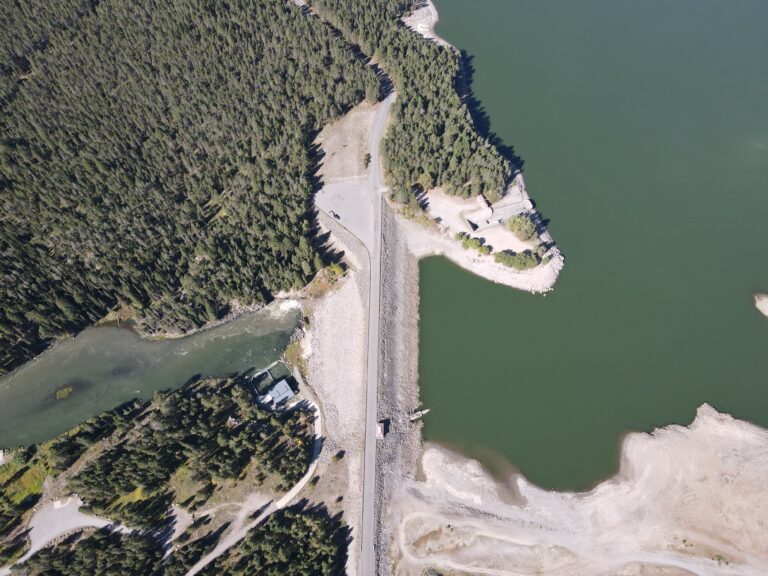
Drone photo of Island Park Dam taken on September 9, 2026 Looking Back on September September brought lows and highs to Island Park. Island Park Reservoir started September at 29% full and quickly fell to a low of 12% full on September 19. The rapid drawdown of the reservoir was the result of managers needing to move water downstream to American Falls (to irrigate farms in the Magic Valley with senior water rights). Such low
This story was written by Audrey Hunter (2026 intern) and was originally published in the Fall 2026 Newsletter. It’s no secret that late summers on Island Park Reservoir haven’t been in perfect conditions in recent years. Warm, turbid, algae-filled water plague reservoir recreationists while diminishing water quality downstream. Cyclical algal blooms decrease water clarity and create less-than-ideal circumstances for the reservoir’s flora and fauna. What’s the solution? HFF’s DIRTT Plan. In-Reservoir Oxygenation Nutrients released from
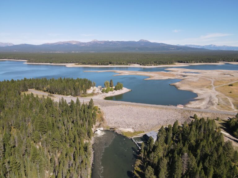
Drone photo taken on September 9, 2026 The Henry’s Fork Drought Management Planning Committee met on Wednesday, September 16 2026 to develop an updated reservoir management strategy. Downstream of the Henry’s Fork watershed, lower-valley irrigation demand over the rest of the season is anticipated to be slightly lower than projected last week, so Island Park Reservoir and Grassy Lake (in the Fall River drainage) do not need to deliver any more water out of the